Watch it draw itself · tap to replay
How to Draw a Mississippi Map
Draw a mississippi map in 11 easy steps, about 8 minutes. Free, with a printable worksheet.
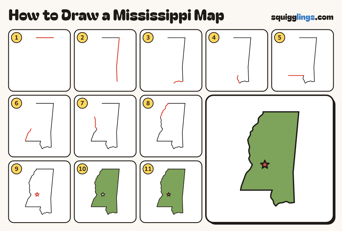
Each picture adds one red line. Draw that line, then scroll to the next picture. Rub out any dashed helper lines at the end. First up: the top edge.
Step 1: The top edge
Start near the top, left of the middle. Draw a straight line to the right. Stop near the right side.
Tip Mississippi is tall and thin. Leave lots of room below this line.
Step 2: The right side
From the right end, draw a long straight line down, leaning a tiny bit left, then straight down.
Tip Use a ruler if you like. This side is much longer than the top.
Step 3: The sea coast
Carry on from the bottom. Draw a short wavy line to the left, dipping down at the end.
Tip This little coast is on the Gulf of Mexico.
Step 4: Up the river
Carry on from the dip. Wiggle a short line up, leaning left. Stop at a corner.
Step 5: The flat step
From the corner, draw a straight line to the left. Stop when it is nearly as long as the top.
Step 6: The big river
Carry on from there. Draw a wavy line up, leaning right. Stop a third of the way up.
Tip All of this wiggly left side is one huge river, the Mississippi.
Step 7: More river
Carry on from there. Wiggle a line up with small bends. Stop two thirds of the way up.
Step 8: Close the map
Carry on from there. Wiggle a line up, leaning right. Join the start of your top line.
Step 9: The capital star
Below the middle, nearer the wiggly river side, draw a star for the capital city, Jackson.
Tip On a map, a star shows the capital city.
Step 10: Green land
Go over your lines. Colour all the land green, around the star.
Step 11: Red star
Colour the star red. Your map of Mississippi is done!
Your finished drawing
Follow the steps above and this is where you end up: a mississippi map, drawn by you.
Every step in one picture